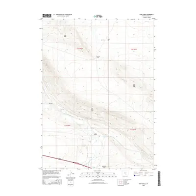
2015 Map of Fort Steele
USGS Topo · Published 2015About this map
Fort Steele sits as a central landmark in this Carbon County landscape, situated where the North Platte River winds through the high desert. The terrain is defined by dramatic elevations and natural gateways, including Boneside Pass and the steep Fort Steele Breaks. To the north and west, the heights of Cedar Ridge and Mt Steele overlook the drainage patterns of Taylor Draw and Wet Draw. Modern transit corridors like Co Road 347 and remnants of the Old Hwy trace the historical movement of people through this corridor. The presence of Alkali Flat and the seasonal courses of Saint Marys Cr illustrate the arid environment that has long dictated the placement of trails and settlements in this part of Wyoming.
Find a feature on this map
21 named features on this map. Tap any name to fly to it.
Don’t see what you’re looking for? This feature index may not catch every label — zoom into the map to look around manually.
Map Details
Editions of this 2015 Fort Steele Map
This is the sole edition of this map. No revisions or reprints were ever made.
Other maps of this area

1893 · Fort Steele
USGS Topo · 1:125,000

1914 · Walcott
USGS Topo · 1:62,500

1953 · Sinclair
USGS Topo · 1:24,000

1953 · Lone Haystack Mountain
USGS Topo · 1:24,000

1954 · Rawlins
USGS Topo · 1:250,000

1955 · Meads
USGS Topo · 1:24,000

1955 · Savage Ranch
USGS Topo · 1:24,000

1956 · Bolten Ranch
USGS Topo · 1:62,500

1958 · Rawlins
USGS Topo · 1:250,000

1962 · Rawlins
USGS Topo · 1:250,000