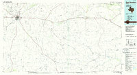
1985 Map of Fort Stockton
USGS Topo · Published 1986About this map
Fort Stockton serves as the primary hub of activity in this mid-1980s look at the Pecos County landscape, where the Atwison Topeka and Santa Fe railroad line meets a network of local roads. The town's layout is well-defined, including the City-County Airport and a local Cem, while the surrounding terrain is dominated by prominent landforms like Big Mesa, Sevenmile Mesa, and Twelvemile Mesa.
Find a feature on this map
50 named features on this map. Tap any name to fly to it.
Don’t see what you’re looking for? This feature index may not catch every label — zoom into the map to look around manually.
Map Details
Editions of this 1985 Fort Stockton Map
2 editions found
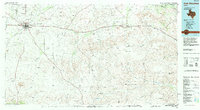
Other maps of this area

1920 · Longfellow
USGS Topo · 1:125,000

1921 · Fort Stockton
USGS Topo · 1:62,500

1923 · Fort Stockton
USGS Topo · 1:62,500

1923 · Hess Canyon
USGS Topo · 1:62,500

1923 · Sierra Madera
USGS Topo · 1:62,500

1928 · Crane
USGS Topo · 1:125,000

1928 · Sanderson
USGS Topo · 1:125,000

1928 · Rankin
USGS Topo · 1:125,000

1928 · Comanche Spring
USGS Topo · 1:125,000

1929 · Sheffield
USGS Topo · 1:125,000
Featured Places
- Fort Stockton, TX
- Little Mexico Colonia, TX
- Guild, TX
- Bodieville Colonia, TX
- Alamo Ranchettes Colonia, TX