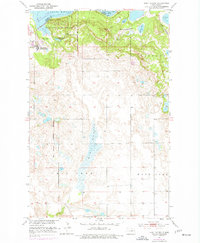
1951 Map of Fort Totten
USGS Topo · Published 1977About this map
Fort Totten and its adjacent Fort Totten Indian Agency serve as the primary focal point of this Benson County landscape during the mid-20th century. The settlement sits at the edge of the Sullys Hill National Game Preserve, a terrain defined by the prominent Sullys Hill and recreational features like a Ski Jump. The map clearly delineates the Old Military Reservation Boundary, providing a geographic anchor for the historical transition from a frontier post to a regional agency. To the north, the waters of Devils Lake and Sweetwater Lake dominate the drainage pattern, while the Great Northern railroad provides a vital transportation link on the eastern edge. Local education and community life are marked by the presence of the East Side Day Sch and Lone Tree Sch No 1, which speak to the rural distribution of the population across the Dakota prairie.
Find a feature on this map
20 named features on this map. Tap any name to fly to it.
Don’t see what you’re looking for? This feature index may not catch every label — zoom into the map to look around manually.
Map Details
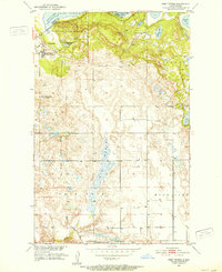
Editions of this 1951 Fort Totten Map
2 editions found
Other maps of this area

1928 · Tokio
USGS Topo · 1:62,500

1931 · Oberon
USGS Topo · 1:62,500

1931 · Tokio
USGS Topo · 1:62,500

1931 · Devils Lake
USGS Topo · 1:62,500

1932 · Grahams Island
USGS Topo · 1:62,500

1950 · Sheyenne
USGS Topo · 1:24,000
1950 · Tokio SW
USGS Topo · 1:24,000

1950 · Tokio
USGS Topo · 1:24,000

1950 · Grahams Island
USGS Topo · 1:62,500

1950 · Devils Lake
USGS Topo · 1:62,500
Featured Places
- Wood Lake District, ND
- St. Michael District, ND
- Fort Totten District, ND
- Fort Totten, Fort Totten District
- Ramsey County, ND