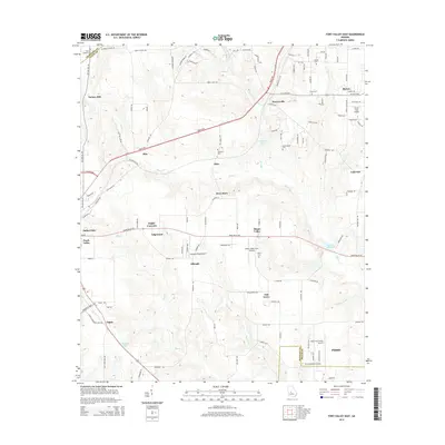
2014 Map of Fort Valley East
USGS Topo · Published 2014About this map
Fort Valley and Perry anchor this landscape in central Georgia, where small-town growth meets an extensive network of creeks and rural crossroads. The area between these centers is defined by a dense collection of family and community cemeteries, including Wesley Chapel Cem, Lisenby Cem, and Scattergood Cem, which offer significant value for genealogical research. Aviation is a prominent theme in the local infrastructure, with multiple facilities like Smith Field Airport, Cameron Field Airport, and the Perry-Fort Valley Airport serving the region.
Find a feature on this map
126 named features on this map. Tap any name to fly to it.
Don’t see what you’re looking for? This feature index may not catch every label — zoom into the map to look around manually.
Map Details
Editions of this 2014 Fort Valley East Map
This is the sole edition of this map. No revisions or reprints were ever made.
Other maps of this area

1956 · Fort Valley
USGS Topo · 1:62,500

1956 · Perry
USGS Topo · 1:62,500

1956 · Warner Robins
USGS Topo · 1:62,500

1957 · Macon
USGS Topo · 1:250,000

1958 · Macon
USGS Topo · 1:250,000

1964 · Macon
USGS Topo · 1:250,000
1972 · Marshallville
USGS Topo · 1:24,000

1972 · Perry West
USGS Topo · 1:24,000
1973 · Fort Valley West
USGS Topo · 1:24,000
1973 · Warner Robins SW
USGS Topo · 1:24,000