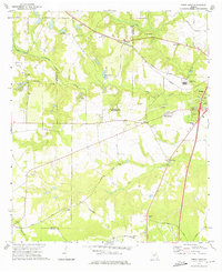
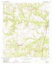
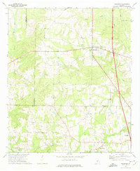
1972 Map of Perry West
USGS Topo · Published 1975About this map
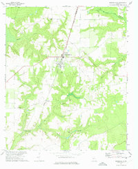
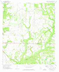
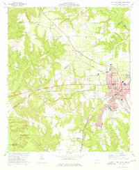
Big Indian Creek and its various tributaries, including Baptist Creek and Flat Creek, carve a rolling landscape across the rural intersections of Peach, Macon, and Houston counties. This 1970s survey captures a transition between traditional agriculture and modern infrastructure, evidenced by the scattered small communities like Myrtle and Clopine alongside newer developments such as Oak Knolls and Meadowdale. The eastern edge of the sheet shows the expanding outskirts of Perry, featuring the Westfield Sch and a large concentration of Industrial Waste Ponds.
Find a feature on this map
50 named features on this map. Tap any name to fly to it.
Don’t see what you’re looking for? This feature index may not catch every label — zoom into the map to look around manually.
Map Details
Editions of this 1972 Perry West Map
2 editions found
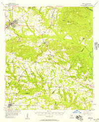
Other maps of this area

1956 · Fort Valley
USGS Topo · 1:62,500
1956 · Perry
USGS Topo · 1:62,500

1956 · Warner Robins
USGS Topo · 1:62,500

1957 · Macon
USGS Topo · 1:250,000

1958 · Macon
USGS Topo · 1:250,000

1964 · Macon
USGS Topo · 1:250,000
1971 · Henderson
USGS Topo · 1:24,000
1972 · Marshallville
USGS Topo · 1:24,000
1972 · Marshallville SW
USGS Topo · 1:24,000
1973 · Fort Valley West
USGS Topo · 1:24,000