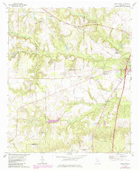
1972 Map of Perry West
USGS Topo · Published 1984About this map
Big Indian Creek and its many tributaries carve through the landscape west of Perry, where the rail line of the Central of Georgia connects the rural communities of Myrtle and Clopine. This 1970s landscape is defined by its transition from the developing outskirts of Perry to more remote agricultural and wooded tracts. The map reveals a dense network of local spiritual and community centers, including Richland Ch, Baptist Creek Ch, and Browns Chapel, often accompanied by their respective cemeteries such as Richland Ch Cem.
Find a feature on this map
43 named features on this map. Tap any name to fly to it.
Don’t see what you’re looking for? This feature index may not catch every label — zoom into the map to look around manually.
Map Details
Editions of this 1972 Perry West Map
2 editions found
Other maps of this area

1956 · Fort Valley
USGS Topo · 1:62,500

1956 · Perry
USGS Topo · 1:62,500

1956 · Warner Robins
USGS Topo · 1:62,500

1957 · Macon
USGS Topo · 1:250,000

1958 · Macon
USGS Topo · 1:250,000

1964 · Macon
USGS Topo · 1:250,000

1971 · Henderson
USGS Topo · 1:24,000
1972 · Marshallville
USGS Topo · 1:24,000
1972 · Marshallville SW
USGS Topo · 1:24,000

1972 · Perry West
USGS Topo · 1:24,000