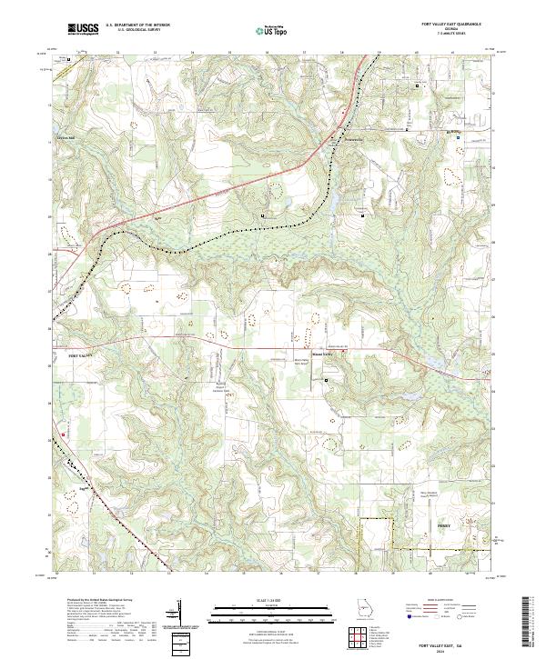
2024 Map of Fort Valley East
USGS Topo · Published 2024About this map
The drainage basins of Mossy Creek and Mule Creek define the landscape between the growing Georgia municipalities of Fort Valley, Byron, and Perry. This modern topographic study reveals a transition from the agricultural heritage of Miami Valley to the increasing aviation infrastructure of central Georgia. The area is dotted with small family and community burial sites such as Diamond Cem, Cliett Cem, and Scattergood Cem, providing essential markers for genealogical research in this corridor.
Find a feature on this map
124 named features on this map. Tap any name to fly to it.
Don’t see what you’re looking for? This feature index may not catch every label — zoom into the map to look around manually.
Map Details
Editions of this 2024 Fort Valley East Map
This is the sole edition of this map. No revisions or reprints were ever made.
Other maps of this area

1956 · Fort Valley
USGS Topo · 1:62,500

1956 · Perry
USGS Topo · 1:62,500

1956 · Warner Robins
USGS Topo · 1:62,500

1957 · Macon
USGS Topo · 1:250,000

1958 · Macon
USGS Topo · 1:250,000

1964 · Macon
USGS Topo · 1:250,000
1972 · Marshallville
USGS Topo · 1:24,000

1972 · Perry West
USGS Topo · 1:24,000
1973 · Fort Valley West
USGS Topo · 1:24,000
1973 · Warner Robins SW
USGS Topo · 1:24,000