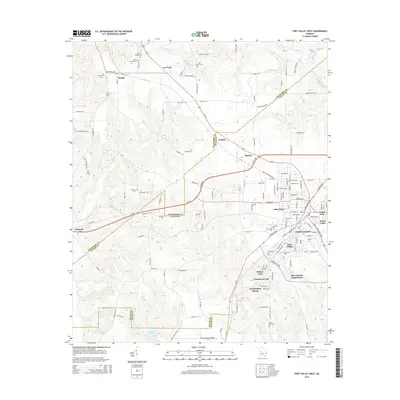
2014 Map of Fort Valley West
USGS Topo · Published 2014About this map
Fort Valley serves as the hub of this Peach County corridor, where the campus of Ft Valley State Univ and State College stand as prominent local landmarks. The landscape is dotted with ancestral burial grounds such as Oak Lawn Cem and Ross Chapel Cem, providing essential points of reference for genealogical research. Small settlements like Zenith, Lee Pope, and Grogan are connected by a network of rural routes including Us-341 and Ga-96.
Find a feature on this map
138 named features on this map. Tap any name to fly to it.
Don’t see what you’re looking for? This feature index may not catch every label — zoom into the map to look around manually.
Map Details
Editions of this 2014 Fort Valley West Map
This is the sole edition of this map. No revisions or reprints were ever made.
Other maps of this area

1955 · Phenix City
USGS Topo · 1:250,000

1956 · Fort Valley
USGS Topo · 1:62,500

1957 · Phenix City
USGS Topo · 1:250,000

1957 · Macon
USGS Topo · 1:250,000

1958 · Macon
USGS Topo · 1:250,000

1958 · Phenix City
USGS Topo · 1:250,000

1964 · Macon
USGS Topo · 1:250,000

1971 · Reynolds
USGS Topo · 1:24,000
1971 · Roberta
USGS Topo · 1:24,000

1971 · Garden Valley
USGS Topo · 1:24,000