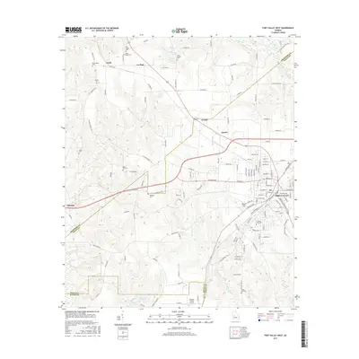
2017 Map of Fort Valley West
USGS Topo · Published 2017About this map
Fort Valley serves as the primary urban center for this Peach County landscape, anchored by the campus of Ft Valley State Univ. The topography is defined by the drainage basins of Big Indian Cr and Indian Cr, which have historically shaped the agricultural and settlement patterns of the region. Scattered rural communities such as Lee Pope, Zenith, and Nakomis provide a look at the residential clusters that dot the farmland and rolling hills outside the main town.
Find a feature on this map
138 named features on this map. Tap any name to fly to it.
Don’t see what you’re looking for? This feature index may not catch every label — zoom into the map to look around manually.
Map Details
Editions of this 2017 Fort Valley West Map
This is the sole edition of this map. No revisions or reprints were ever made.
Other maps of this area

1955 · Phenix City
USGS Topo · 1:250,000

1956 · Fort Valley
USGS Topo · 1:62,500

1957 · Phenix City
USGS Topo · 1:250,000

1957 · Macon
USGS Topo · 1:250,000

1958 · Macon
USGS Topo · 1:250,000

1958 · Phenix City
USGS Topo · 1:250,000

1964 · Macon
USGS Topo · 1:250,000

1971 · Reynolds
USGS Topo · 1:24,000
1971 · Roberta
USGS Topo · 1:24,000

1971 · Garden Valley
USGS Topo · 1:24,000