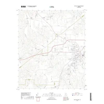
2020 Map of Fort Valley West
USGS Topo · Published 2020About this map
Fort Valley serves as the primary hub of this 2020 landscape, characterized by its significant educational and civic institutions. The presence of Fort Valley State University and the Peach County Courthouse anchors the eastern edge of the sheet, where the urban street grid transitions into the rural acreage of central Georgia. The surrounding countryside is dotted with numerous small settlements and family or church-affiliated landmarks, including Lee Pope, Zenith, and Grogan.
Find a feature on this map
136 named features on this map. Tap any name to fly to it.
Don’t see what you’re looking for? This feature index may not catch every label — zoom into the map to look around manually.
Map Details
Editions of this 2020 Fort Valley West Map
This is the sole edition of this map. No revisions or reprints were ever made.
Other maps of this area

1955 · Phenix City
USGS Topo · 1:250,000

1956 · Fort Valley
USGS Topo · 1:62,500

1957 · Phenix City
USGS Topo · 1:250,000

1957 · Macon
USGS Topo · 1:250,000

1958 · Macon
USGS Topo · 1:250,000

1958 · Phenix City
USGS Topo · 1:250,000

1964 · Macon
USGS Topo · 1:250,000

1971 · Reynolds
USGS Topo · 1:24,000
1971 · Roberta
USGS Topo · 1:24,000

1971 · Garden Valley
USGS Topo · 1:24,000