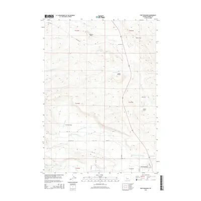
2015 Map of Fort Washakie
USGS Topo · Published 2015About this map
Fort Washakie serves as the primary hub of this landscape, situated at the junction of the North Fork Little Wind River and the South Fork Little Wind River. This 2015 survey reveals a terrain defined by significant water management and varied topography, where irrigation infrastructure like N Fork Ditch Number 1 and N Fork Ditch Number 2 cuts through the Countryman Basin to support the surrounding valley. The topography rises toward the north and east, marked by distinctive high points such as Sandstone Butte, Juniper Butte, and the prominent Bighorn Ridge. Riparian corridors like Norkok Meadows follow the path of Norkok Cr, while a network of named local routes including Washakie Park Rd and N Fork Rd connect the scattered dwellings and basins of this Fremont County region.
Find a feature on this map
32 named features on this map. Tap any name to fly to it.
Don’t see what you’re looking for? This feature index may not catch every label — zoom into the map to look around manually.
Map Details
Editions of this 2015 Fort Washakie Map
This is the sole edition of this map. No revisions or reprints were ever made.
Other maps of this area

1937 · Moccasin Lake
USGS Topo · 1:48,000

1943 · Moccasin Lake
USGS Topo · 1:62,500

1951 · Morton
USGS Topo · 1:24,000

1951 · Fort Washakie
USGS Topo · 1:24,000

1951 · Bull Lake East
USGS Topo · 1:24,000

1951 · Argo Butte
USGS Topo · 1:24,000

1951 · Ethete
USGS Topo · 1:24,000

1952 · Wise Flat
USGS Topo · 1:24,000

1952 · Ray Lake
USGS Topo · 1:24,000

1952 · Wind River
USGS Topo · 1:24,000