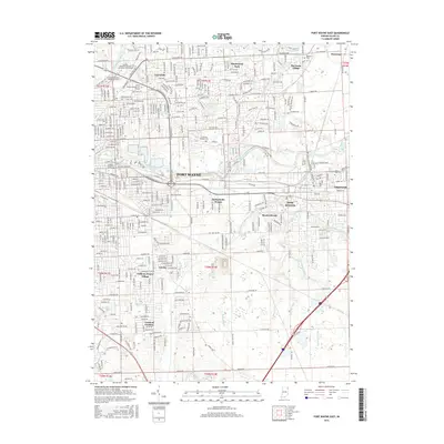
2016 Map of Fort Wayne East
USGS Topo · Published 2016About this map
The Maumee River and Saint Joseph River converge in this eastern section of Fort Wayne, a landscape defined by its complex drainage network and expanding educational hubs. Major institutions including Indiana University-Purdue University-Fort Wayne and Ivy Tech Community College-Northeast anchor the northern reaches of the city, while neighborhoods like Hacienda Village and Sunnymede Woods illustrate the residential growth surrounding the city core. To the east, New Haven stands as a distinct municipality, connected to the larger metropolitan area by thoroughfares like New Haven Ave and E Washington Blvd. The southern portion of the map transitions into a more orderly grid of rural ditches and roads, such as Schneider Ditch and Maples Rd, tracing the hydrological management necessary for this part of Allen County.
Find a feature on this map
47 named features on this map. Tap any name to fly to it.
Don’t see what you’re looking for? This feature index may not catch every label — zoom into the map to look around manually.
Map Details
Editions of this 2016 Fort Wayne East Map
This is the sole edition of this map. No revisions or reprints were ever made.
Other maps of this area

1953 · Fort Wayne
USGS Topo · 1:250,000

1953 · Muncie
USGS Topo · 1:250,000

1956 · Muncie
USGS Topo · 1:250,000

1956 · Fort Wayne
USGS Topo · 1:250,000

1956 · Fort Wayne West
USGS Topo · 1:24,000

1956 · Fort Wayne East
USGS Topo · 1:24,000

1956 · Cedarville
USGS Topo · 1:24,000

1957 · Maples
USGS Topo · 1:24,000

1957 · Huntertown
USGS Topo · 1:24,000

1958 · Grabill
USGS Topo · 1:24,000