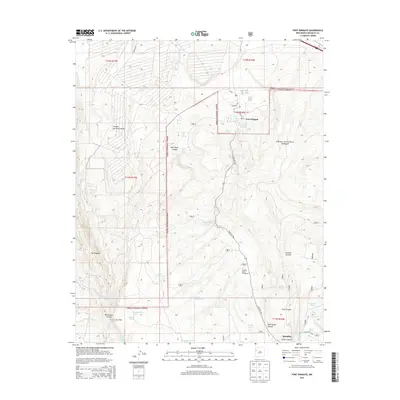
2013 Map of Fort Wingate
USGS Topo · Published 2013About this map
Fort Wingate stands at the center of this mountain landscape, positioned along the edge of the Cibola National Forest. The map documents a rugged high-desert environment characterized by deep canyons and significant geological features like The Hogback. The settlement at McGaffey and the nearby McGaffey Lake highlight the historical importance of water resources in the Zuni Mountains, evidenced by numerous named springs such as Fort Wingate Spring and Milk Ranch Spring.
Find a feature on this map
42 named features on this map. Tap any name to fly to it.
Don’t see what you’re looking for? This feature index may not catch every label — zoom into the map to look around manually.
Map Details
Editions of this 2013 Fort Wingate Map
This is the sole edition of this map. No revisions or reprints were ever made.
Other maps of this area

1886 · Wingate
USGS Topo · 1:250,000

1892 · Wingate
USGS Topo · 1:250,000

1954 · Gallup
USGS Topo · 1:250,000

1958 · Gallup
USGS Topo · 1:250,000

1959 · Gallup
USGS Topo · 1:250,000

1962 · Gallup
USGS Topo · 1:250,000

1962 · Ciniza
USGS Topo · 1:24,000

1962 · Page
USGS Topo · 1:24,000
1963 · Pinedale
USGS Topo · 1:24,000
1963 · Church Rock
USGS Topo · 1:24,000