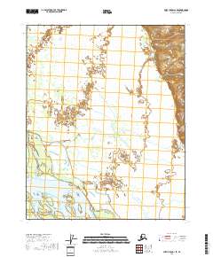
2018 Map of Fort Yukon A-1 SE
USGS Topo · Published 2018About this map
The Yukon River dominates this interior Alaskan landscape, characterized by the complex hydrology of the Yukon Flats. The river channels and adjacent Twenty-Two Mile Slough demonstrate the shifting nature of the waterways, where braided streams and seasonal sediment deposits create transient landforms like Okalee Spit. This 2018 survey by the U.S. Geological Survey provides a precise view of the terrain within the Yukon-Koyukuk Census Area, illustrating how the water cuts through the low-lying wetland environment. The map details the vast network of small lakes and marshes typical of this subarctic floodplain, offering a snapshot of the region's natural geography before further environmental shifts occur.
Find a feature on this map
7 named features on this map. Tap any name to fly to it.
Don’t see what you’re looking for? This feature index may not catch every label — zoom into the map to look around manually.
Map Details
Editions of this 2018 Fort Yukon A-1 SE Map
This is the sole edition of this map. No revisions or reprints were ever made.
Other maps of this area

1951 · Fort Yukon
USGS Topo · 1:250,000

1951 · Charley River
USGS Topo · 1:250,000

1951 · Black River
USGS Topo · 1:250,000

1951 · Circle
USGS Topo · 1:250,000

1955 · Circle D-1
USGS Topo · 1:63,360

1955 · Circle
USGS Topo · 1:250,000

1956 · Fort Yukon A-1
USGS Topo · 1:63,360

1956 · Black River A-6
USGS Topo · 1:63,360

1956 · Fort Yukon
USGS Topo · 1:250,000

1956 · Black River
USGS Topo · 1:250,000