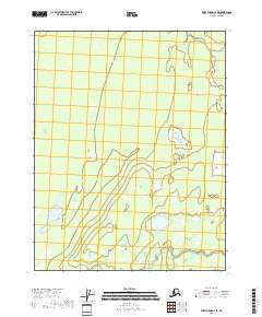
2018 Map of Fort Yukon C-1 SE
USGS Topo · Published 2018About this map
Grass River meanders across this low-lying landscape, defining the character of the southeastern Fort Yukon C-1 SE quadrangle. The terrain is marked by a complex network of wetlands and small water bodies, indicative of the alluvial processes at work north of the Arctic Circle. The absence of roads or permanent settlements in this 2018 survey emphasizes the isolation of the Yukon-Koyukuk region, where the natural hydrography governs the land. Surveyed boundaries for Township 19, 20, and 21 North delineate the vast reaches of the interior, providing a foundational grid for land management in this remote stretch of the Alaska wilderness.
Find a feature on this map
7 named features on this map. Tap any name to fly to it.
Don’t see what you’re looking for? This feature index may not catch every label — zoom into the map to look around manually.
Map Details
Editions of this 2018 Fort Yukon C-1 SE Map
This is the sole edition of this map. No revisions or reprints were ever made.
Other maps of this area

1951 · Fort Yukon
USGS Topo · 1:250,000

1951 · Black River
USGS Topo · 1:250,000

1956 · Fort Yukon C-1
USGS Topo · 1:63,360

1956 · Black River B-6
USGS Topo · 1:63,360

1956 · Black River C-6
USGS Topo · 1:63,360

1956 · Fort Yukon B-1
USGS Topo · 1:63,360

1956 · Fort Yukon
USGS Topo · 1:250,000

1956 · Black River
USGS Topo · 1:250,000

1964 · Black River
USGS Topo · 1:250,000
2018 · Fort Yukon B-1 NW
USGS Topo · 1:25,000