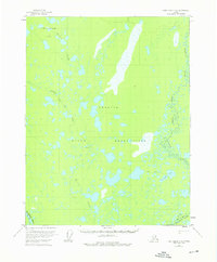
1956 Map of Fort Yukon D-4
USGS Topo · Published 1976About this map
The Venetie Indian Reservation dominates this mid-century Alaskan landscape, a territory defined by a vast labyrinth of water and seasonal transport routes. The hydrology is incredibly dense, characterized by the sprawling Veh-Tenjerlow Lakes in the north and the meandering Christian River which forms a complex, braided eastern boundary. A notable human footprint is found at Tsukon, situated along the winding course of Marten Creek.
Find a feature on this map
13 named features on this map. Tap any name to fly to it.
Don’t see what you’re looking for? This feature index may not catch every label — zoom into the map to look around manually.
Map Details
Editions of this 1956 Fort Yukon D-4 Map
This is the sole edition of this map. No revisions or reprints were ever made.
Other maps of this area

1951 · Fort Yukon
USGS Topo · 1:250,000

1951 · Christian
USGS Topo · 1:250,000

1952 · Fort Yukon C-3
USGS Topo · 1:63,360

1952 · Fort Yukon C-4
USGS Topo · 1:63,360

1955 · Fort Yukon D-3
USGS Topo · 1:63,360

1955 · Fort Yukon D-4
USGS Topo · 1:63,360

1955 · Fort Yukon C-3
USGS Topo · 1:63,360

1955 · Fort Yukon D-5
USGS Topo · 1:63,360

1955 · Fort Yukon C-5
USGS Topo · 1:63,360

1956 · Fort Yukon C-5
USGS Topo · 1:63,360