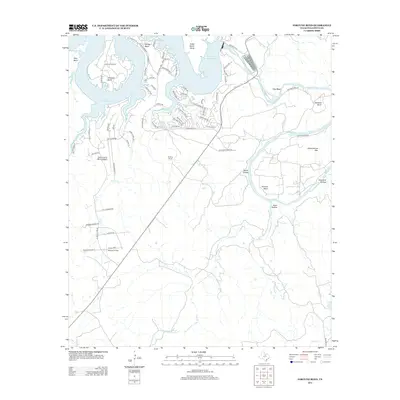
2012 Map of Fortune Bend
USGS Topo · Published 2012About this map
Possum Kingdom Lake and the meandering Brazos River dominate this landscape in Palo Pinto County, where deep water and sharp elevation changes define the local geography. The map reveals a complex interface between recreation and industry, showing the extensive residential development of Gaines Bend and Oyster Bay alongside the Belding Oil Field and the expansive Belding Ranch. The river’s winding course is marked by several notable geological formations, including Fortune Bend, Garland Bend, and Flint Bend. Inland from the water, the terrain rises toward Schoolhouse Mtn, while Jowell Cr and Ioni Cr drain the surrounding hills. Facilities like Camp Constantin and the Sportsman's World Airport indicate the area's role as a regional hub for outdoor activity and seasonal residency during this era.
Find a feature on this map
76 named features on this map. Tap any name to fly to it.
Don’t see what you’re looking for? This feature index may not catch every label — zoom into the map to look around manually.
Map Details
Editions of this 2012 Fortune Bend Map
This is the sole edition of this map. No revisions or reprints were ever made.
Other maps of this area

1890 · Breckenridge
USGS Topo · 1:125,000

1891 · Palo Pinto
USGS Topo · 1:125,000

1918 · Palo Pinto
USGS Topo · 1:125,000

1924 · Breckenridge 1-a
USGS Topo · 1:48,000

1924 · Palo Pinto 2-b
USGS Topo · 1:48,000

1924 · Palo Pinto 2-a
USGS Topo · 1:48,000

1924 · Palo Pinto 2-c
USGS Topo · 1:48,000

1924 · Breckenridge 1-d
USGS Topo · 1:48,000

1927 · Pickwick
USGS Topo · 1:62,500

1931 · Ivan
USGS Topo · 1:62,500