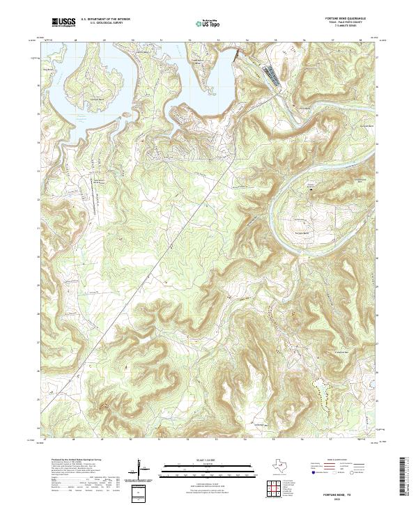
2022 Map of Fortune Bend
USGS Topo · Published 2022About this map
The Brazos River carves a dramatic, winding path through Palo Pinto County, creating a series of deep loops known as Hog Bend, Gaines Bend, and Fortune Bend. In the northwest, the river expands into the high-traffic waters of Possum Kingdom Lake, a central landmark for recreation and residential development in this part of Texas. The iconic limestone cliffs of Hells Gate mark the entry to one of the lake's prominent inlets, while Sportsman's World Airport provides regional access.
Find a feature on this map
76 named features on this map. Tap any name to fly to it.
Don’t see what you’re looking for? This feature index may not catch every label — zoom into the map to look around manually.
Map Details
Editions of this 2022 Fortune Bend Map
This is the sole edition of this map. No revisions or reprints were ever made.
Other maps of this area

1890 · Breckenridge
USGS Topo · 1:125,000

1891 · Palo Pinto
USGS Topo · 1:125,000

1918 · Palo Pinto
USGS Topo · 1:125,000

1924 · Breckenridge 1-a
USGS Topo · 1:48,000

1924 · Palo Pinto 2-b
USGS Topo · 1:48,000

1924 · Palo Pinto 2-a
USGS Topo · 1:48,000

1924 · Palo Pinto 2-c
USGS Topo · 1:48,000

1924 · Breckenridge 1-d
USGS Topo · 1:48,000

1927 · Pickwick
USGS Topo · 1:62,500

1931 · Ivan
USGS Topo · 1:62,500