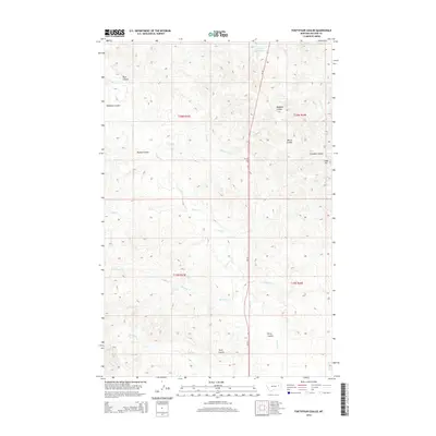
2014 Map of Fortyfour Coulee
USGS Topo · Published 2014About this map
MT-24 bisects this McCone County landscape, serving as the primary corridor through a region defined by an intricate network of drainage coulees and seasonal creeks. The terrain is marked by named features that likely reflect local ranching history and family landholdings, such as Bigney Coulee and Morris Coulee. To the northeast, the elevation rises toward Cobb Hill, while the water management of this arid environment is evidenced by the presence of the Leaky Reservoir near the northern boundary.
Find a feature on this map
23 named features on this map. Tap any name to fly to it.
Don’t see what you’re looking for? This feature index may not catch every label — zoom into the map to look around manually.
Map Details
Editions of this 2014 Fortyfour Coulee Map
This is the sole edition of this map. No revisions or reprints were ever made.
Other maps of this area

1954 · Jordan
USGS Topo · 1:250,000

1956 · Jordan
USGS Topo · 1:250,000

1958 · Jordan
USGS Topo · 1:250,000

1964 · Jordan
USGS Topo · 1:250,000

1967 · Coal Creek
USGS Topo · 1:24,000

1967 · Frank Coulee
USGS Topo · 1:24,000

1972 · Short Creek
USGS Topo · 1:24,000

1973 · Rodgers Hall
USGS Topo · 1:24,000

1973 · Nelson Creek Bay
USGS Topo · 1:24,000

1978 · Fort Peck Lake East
USGS Topo · 1:100,000