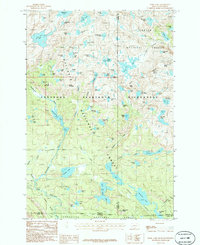
1986 Map of Fossil Lake
USGS Topo · Published 1986About this map
Fossil Lake and the surrounding high-altitude plateaus of the Absaroka Beartooth Wilderness dominate this 1980s landscape at the Montana-Wyoming border. This environment is characterized by an exceptional density of glacial tarns and small water bodies, many with descriptive or peculiar names such as Pneumonia Lake, No Bones Lake, and Fizzle Lake. The map details the convergence of the Gallatin National Forest and Shoshone National Forest, illustrating a region where high peaks like Mount Dewey and Mount Rosebud overlook a network of alpine basins.
Find a feature on this map
88 named features on this map. Tap any name to fly to it.
Don’t see what you’re looking for? This feature index may not catch every label — zoom into the map to look around manually.
Map Details
Editions of this 1986 Fossil Lake Map
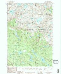
2 editions found
Other maps of this area

1896 · Crandall Creek
USGS Topo · 1:125,000

1898 · Granite Mountain District
USGS Topo · 1:125,000

1899 · Crandall
USGS Topo · 1:125,000

1954 · Billings
USGS Topo · 1:250,000

1955 · Cody
USGS Topo · 1:250,000

1956 · Alpine
USGS Topo · 1:62,500

1956 · Beartooth Butte
USGS Topo · 1:62,500

1956 · Cooke City
USGS Topo · 1:62,500

1956 · Pilot Peak
USGS Topo · 1:62,500

1957 · Billings
USGS Topo · 1:250,000