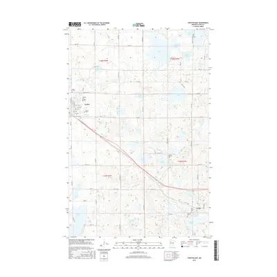
2016 Map of Fosston East
USGS Topo · Published 2016About this map
Fosston and Lengby anchor this portion of the northwestern Minnesota landscape, situated along a transportation corridor that cuts diagonally through a dense network of glacial lakes. The area is marked by a significant concentration of local cemeteries, including Rosehill Cem, Kingo Cem, and Landstad Cem, which serve as vital landmarks for tracing the heritage of these rural townships. The watery terrain is defined by the Sand Hill River and Poplar River, which thread through a sequence of bodies such as Whitefish Lake, Turtle Lake, and the connected waters of North Connection Lake and South Connection Lake.
Find a feature on this map
77 named features on this map. Tap any name to fly to it.
Don’t see what you’re looking for? This feature index may not catch every label — zoom into the map to look around manually.
Map Details
Editions of this 2016 Fosston East Map
This is the sole edition of this map. No revisions or reprints were ever made.
Other maps of this area

1919 · Fosston
USGS Topo · 1:62,500

1954 · Bemidji
USGS Topo · 1:250,000

1957 · Bemidji
USGS Topo · 1:250,000

1958 · Bemidji
USGS Topo · 1:250,000

1969 · Ebro
USGS Topo · 1:24,000

1969 · Olga
USGS Topo · 1:24,000

1969 · Mc Intosh NE
USGS Topo · 1:24,000

1969 · Fosston SE
USGS Topo · 1:24,000

1969 · Fosston East
USGS Topo · 1:24,000

1969 · Fosston West
USGS Topo · 1:24,000