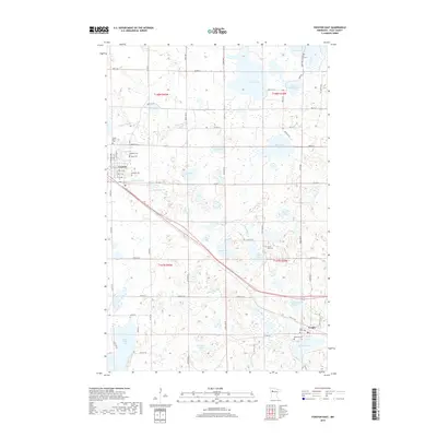
2019 Map of Fosston East
USGS Topo · Published 2019About this map
Fosston and its immediate eastern landscape are defined by a dense concentration of glacial lakes and small cemeteries that anchor the local community. The town's grid, featuring streets like 1st St NE and 4th St NE, gives way to a complex hydrography where First Lake, Second Lake, and Third Lake sit just outside the settlement. The map reveals a high density of burial grounds, including Rosehill Cem, Landstad Cem, and Kingo Cem, suggesting a long-established rural population with deep ties to the land. This pattern of small, scattered cemeteries such as Poplar Lake Cem and Cross Lake Cem reflects the historical importance of local church congregations in the development of Polk County. The landscape is further shaped by the flow of the Poplar River and the Sand Hill River, which connect several larger bodies of water like Turtle Lake and Sand Hill Lake.
Find a feature on this map
63 named features on this map. Tap any name to fly to it.
Don’t see what you’re looking for? This feature index may not catch every label — zoom into the map to look around manually.
Map Details
Editions of this 2019 Fosston East Map
This is the sole edition of this map. No revisions or reprints were ever made.
Other maps of this area

1919 · Fosston
USGS Topo · 1:62,500

1954 · Bemidji
USGS Topo · 1:250,000

1957 · Bemidji
USGS Topo · 1:250,000

1958 · Bemidji
USGS Topo · 1:250,000

1969 · Ebro
USGS Topo · 1:24,000

1969 · Olga
USGS Topo · 1:24,000

1969 · Mc Intosh NE
USGS Topo · 1:24,000

1969 · Fosston SE
USGS Topo · 1:24,000

1969 · Fosston East
USGS Topo · 1:24,000

1969 · Fosston West
USGS Topo · 1:24,000