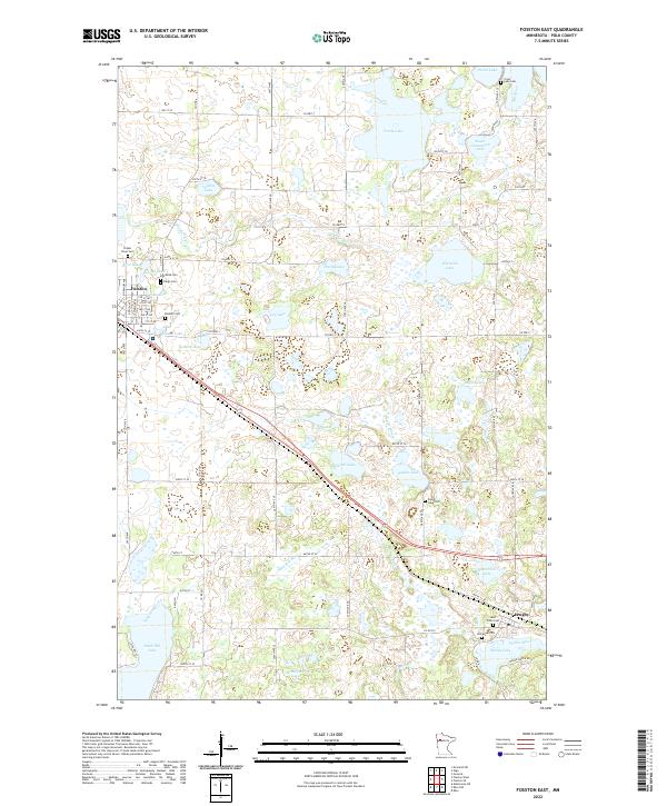
2022 Map of Fosston East
USGS Topo · Published 2022About this map
Glacial lake basins and rolling prairie define the landscape of eastern Polk County, where the city of Fosston serves as a local hub. The area is characterized by an intricate network of water bodies, including Turtle Lake, Volden Lake, and the connected waters of First Lake, Second Lake, and Third Lake. To the southeast, the village of Lengby sits near the headwaters of the Poplar River, surrounded by several historic burial grounds including Saint Pauls Cem and Immanuel Cem. These cemeteries, often associated with early Scandinavian Lutheran congregations like Landstad Cem and Kingo Cem, reflect the late 19th-century settlement patterns of the region. The drainage provided by the Sand Hill River and its various tributaries, such as Sugar Bush Cr, underscores the hydrological importance of this upland terrain, which transitioned from natural tallgrass prairie to a productive agricultural landscape defined by the Public Land Survey System grid.
Find a feature on this map
60 named features on this map. Tap any name to fly to it.
Don’t see what you’re looking for? This feature index may not catch every label — zoom into the map to look around manually.
Map Details
Editions of this 2022 Fosston East Map
This is the sole edition of this map. No revisions or reprints were ever made.
Other maps of this area

1919 · Fosston
USGS Topo · 1:62,500

1954 · Bemidji
USGS Topo · 1:250,000

1957 · Bemidji
USGS Topo · 1:250,000

1958 · Bemidji
USGS Topo · 1:250,000

1969 · Ebro
USGS Topo · 1:24,000

1969 · Olga
USGS Topo · 1:24,000

1969 · Mc Intosh NE
USGS Topo · 1:24,000

1969 · Fosston SE
USGS Topo · 1:24,000

1969 · Fosston East
USGS Topo · 1:24,000

1969 · Fosston West
USGS Topo · 1:24,000