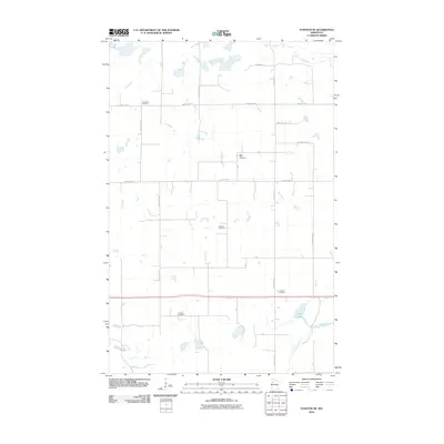
2010 Map of Fosston SE
USGS Topo · Published 2010About this map
Small country burial grounds and an intricate network of township roads define this rural pocket of Polk County. The landscape is heavily marked by the wandering paths of the Hill River and the Lost River, which carve through the agricultural grid in the northern sections. This 2010 survey highlights a deeply rooted community structure, evidenced by the high density of neighborhood cemeteries including Cross Lake Cemetery, Saint Peter Cemetery, and Oakland Cemetery. To the south, the terrain transitions toward the Clearwater River and Third Lake, where the drainage patterns of the Poplar River meet a series of local township routes like TWP HWY T-1 and T-224. The map provides a precise look at the rural infrastructure of the early 21st century, where large-scale farming is supported by a meticulous system of county highways and connecting township roads.
Find a feature on this map
28 named features on this map. Tap any name to fly to it.
Don’t see what you’re looking for? This feature index may not catch every label — zoom into the map to look around manually.
Map Details
Editions of this 2010 Fosston SE Map
This is the sole edition of this map. No revisions or reprints were ever made.
Other maps of this area

1919 · Fosston
USGS Topo · 1:62,500

1943 · Bagley
USGS Topo · 1:62,500

1954 · Bemidji
USGS Topo · 1:250,000

1957 · Bemidji
USGS Topo · 1:250,000

1958 · Bemidji
USGS Topo · 1:250,000

1969 · Ebro
USGS Topo · 1:24,000

1969 · Olga
USGS Topo · 1:24,000

1969 · Clearbrook
USGS Topo · 1:24,000

1969 · Fosston SE
USGS Topo · 1:24,000

1969 · Fosston East
USGS Topo · 1:24,000