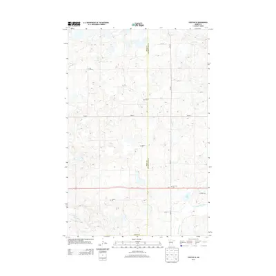
2013 Map of Fosston SE
USGS Topo · Published 2013About this map
The boundary between Polk Co and Clearwater Co defines the eastern portion of this northern Minnesota landscape, a region marked by a complex network of wetlands and river headwaters. In 2013, the terrain is characterized by the meandering paths of the Hill River, Lost River, and Poplar River, which drain through numerous unnamed depressions and lakes typical of the state's glacial till plains. Transportation follows a strict section-line grid, dominated by Us-2 and Co HWY-1, which provide transit across the rural countryside. For those researching local families, the map is remarkably dense with burial sites. Several churchyards and community resting places, including Cross Lake Cem, Saint Peter Cem, Oakland Cem, and Freedom Cem, are distributed throughout the agricultural blocks, often situated near water bodies like Cross Lake or along the arterial roads like Co HWY-7.
Find a feature on this map
27 named features on this map. Tap any name to fly to it.
Don’t see what you’re looking for? This feature index may not catch every label — zoom into the map to look around manually.
Map Details
Editions of this 2013 Fosston SE Map
This is the sole edition of this map. No revisions or reprints were ever made.
Other maps of this area

1919 · Fosston
USGS Topo · 1:62,500

1943 · Bagley
USGS Topo · 1:62,500

1954 · Bemidji
USGS Topo · 1:250,000

1957 · Bemidji
USGS Topo · 1:250,000

1958 · Bemidji
USGS Topo · 1:250,000

1969 · Ebro
USGS Topo · 1:24,000

1969 · Olga
USGS Topo · 1:24,000

1969 · Clearbrook
USGS Topo · 1:24,000

1969 · Fosston SE
USGS Topo · 1:24,000

1969 · Fosston East
USGS Topo · 1:24,000