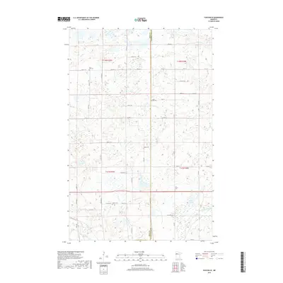
2019 Map of Fosston SE
USGS Topo · Published 2019About this map
The boundary between Polk and Clearwater Counties bisects this northern Minnesota landscape, a terrain defined by its glacial hydrology and dispersed rural heritage. Five distinct community burial grounds, including Fridhem Cem, Our Savior's Cem, and Oakland Cem, serve as cultural anchors for the surrounding townships. The intricate network of small rivers—the Hill River, Lost River, and Poplar River—meanders through a mosaic of wetlands and prairie potholes characteristic of the Red River Valley’s eastern edge. A grid of section-line roads, such as Co Hwy 27 and Co Hwy 1, provides the primary structure for this agricultural region, where the persistence of family and community identity is preserved in labels like Saint Peter Cem and Cross Lake Cem near the banks of the winding waterways.
Find a feature on this map
41 named features on this map. Tap any name to fly to it.
Don’t see what you’re looking for? This feature index may not catch every label — zoom into the map to look around manually.
Map Details
Editions of this 2019 Fosston SE Map
This is the sole edition of this map. No revisions or reprints were ever made.
Other maps of this area

1919 · Fosston
USGS Topo · 1:62,500

1943 · Bagley
USGS Topo · 1:62,500

1954 · Bemidji
USGS Topo · 1:250,000

1957 · Bemidji
USGS Topo · 1:250,000

1958 · Bemidji
USGS Topo · 1:250,000

1969 · Ebro
USGS Topo · 1:24,000

1969 · Olga
USGS Topo · 1:24,000

1969 · Clearbrook
USGS Topo · 1:24,000

1969 · Fosston SE
USGS Topo · 1:24,000

1969 · Fosston East
USGS Topo · 1:24,000