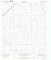
1969 Map of Foster
USGS Topo · Published 1979About this map
Foster and Lahey appear as small, rural outposts in the West Texas landscape of Terry County. The topography is defined by the sweeping course of Sulphur Springs Draw in the south, while the Atchison Topeka and Santa Fe railroad cuts across the northwest corner, signaling the region’s connection to broader commerce. This survey captures a moment when the local economy was driven by both agriculture and resource extraction, visible through numerous Oil Wells and a Cotton Gin situated along the roads. Genealogists may find the Foster Cem particularly valuable for tracing early settlers of the area. The landscape is dotted with scattered Wells and a prominent Water Tank, reflecting the essential nature of water management in this arid environment.
Find a feature on this map
12 named features on this map. Tap any name to fly to it.
Don’t see what you’re looking for? This feature index may not catch every label — zoom into the map to look around manually.
Map Details
Editions of this 1969 Foster Map
2 editions found
Other maps of this area

1954 · Hobbs
USGS Topo · 1:250,000

1954 · Brownfield
USGS Topo · 1:250,000

1958 · Brownfield
USGS Topo · 1:250,000

1958 · Hobbs
USGS Topo · 1:250,000

1962 · Brownfield
USGS Topo · 1:250,000

1969 · Brownfield East
USGS Topo · 1:24,000

1969 · Gomez
USGS Topo · 1:24,000

1969 · Foster
USGS Topo · 1:24,000

1969 · Loop
USGS Topo · 1:24,000

1969 · Ashmore
USGS Topo · 1:24,000