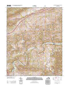
2013 Map of Fosters Falls
USGS Topo · Published 2013About this map
The New River carves a winding path through this portion of Wythe County, defining a landscape of narrow valleys and prominent ridges. Near the southern bend, the settlement of Fosters Falls sits at the base of Hematite Mountain, a name that points to the region's historical iron mining operations. This industrial legacy is further evidenced by Boom Furnace and High Rocks Mill located along the eastern reaches of Little Reed Island Creek.
Find a feature on this map
117 named features on this map. Tap any name to fly to it.
Don’t see what you’re looking for? This feature index may not catch every label — zoom into the map to look around manually.
Map Details
Editions of this 2013 Fosters Falls Map
This is the sole edition of this map. No revisions or reprints were ever made.
Other maps of this area

1889 · Hillsville
USGS Topo · 1:125,000

1890 · Dublin
USGS Topo · 1:125,000

1891 · Dublin
USGS Topo · 1:125,000

1892 · Hillsville
USGS Topo · 1:125,000

1896 · Hillsville
USGS Topo · 1:125,000

1930 · Max Meadows
USGS Topo · 1:62,500

1934 · Pulaski
USGS Topo · 1:48,000

1940 · Pulaski
USGS Topo · 1:62,500

1950 · Radford
USGS Topo · 1:62,500

1953 · Winston-Salem
USGS Topo · 1:250,000