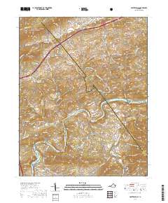
2019 Map of Fosters Falls
USGS Topo · Published 2019About this map
Fosters Falls serves as a focal point along the winding New River, where the landscape is defined by the sharp transition from the heights of Hematite Mtn and Fosters Falls Mtn down to the riverbanks. The area's industrial and community history is visible through scattered settlements like Bertha, Barren Springs, and Boom Furnace, alongside remnants of local milling at High Rocks Mill. The topography is particularly complex near Buckeye Hollow and Alum Hollow, showing the deeply carved drainage patterns of Little Reed Island Creek and Periwinkle Br.
Find a feature on this map
117 named features on this map. Tap any name to fly to it.
Don’t see what you’re looking for? This feature index may not catch every label — zoom into the map to look around manually.
Map Details
Editions of this 2019 Fosters Falls Map
This is the sole edition of this map. No revisions or reprints were ever made.
Other maps of this area

1889 · Hillsville
USGS Topo · 1:125,000

1890 · Dublin
USGS Topo · 1:125,000

1891 · Dublin
USGS Topo · 1:125,000

1892 · Hillsville
USGS Topo · 1:125,000

1896 · Hillsville
USGS Topo · 1:125,000

1930 · Max Meadows
USGS Topo · 1:62,500

1934 · Pulaski
USGS Topo · 1:48,000

1940 · Pulaski
USGS Topo · 1:62,500

1950 · Radford
USGS Topo · 1:62,500

1953 · Winston-Salem
USGS Topo · 1:250,000