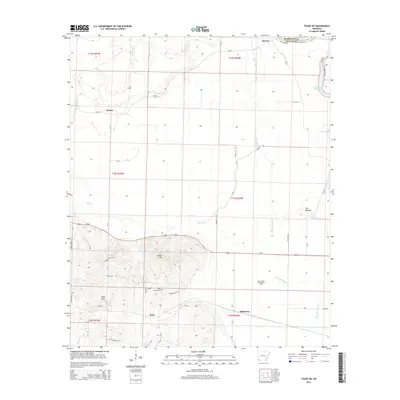
2014 Map of Fouke NE
USGS Topo · Published 2014About this map
Rock Springs Cem sits at the base of Krause Hill in this corner of southwest Arkansas, marking a landscape where the Red River floodplain meets rising upland terrain. The map details the small settlements of Artex, Dooley, McKinney, and Hervey, which are connected by a network of county roads like Ar-296 and Us-82. The eastern edge of the survey reveals the dynamic hydrology of the region, featuring oxbow remnants such as First Old River Lake, Second Old River Lake, and Red Lake. Subsurface industrial activity is noted at the Garland City Oil and Gas Field south of the Moccasin Bayou, while topographic features like Wolf Mtn and The Mounds provide significant vertical relief against the winding course of Red Chute.
Find a feature on this map
53 named features on this map. Tap any name to fly to it.
Don’t see what you’re looking for? This feature index may not catch every label — zoom into the map to look around manually.
Map Details
Editions of this 2014 Fouke NE Map
This is the sole edition of this map. No revisions or reprints were ever made.
Other maps of this area

1951 · Homan
USGS Topo · 1:24,000

1951 · Fulton
USGS Topo · 1:24,000

1951 · Spring Hill
USGS Topo · 1:24,000

1952 · Mandeville
USGS Topo · 1:24,000

1952 · Garland
USGS Topo · 1:24,000

1952 · Fouke SE
USGS Topo · 1:24,000

1952 · Fouke
USGS Topo · 1:24,000

1952 · Fouke NE
USGS Topo · 1:24,000

1952 · Boyd Hill
USGS Topo · 1:24,000

1953 · El Dorado
USGS Topo · 1:250,000