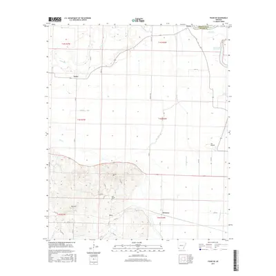
2017 Map of Fouke NE
USGS Topo · Published 2017About this map
Finn Bayou and the winding course of Red Chute dominate this southwest Arkansas landscape, where the floodplain's oxbow history is preserved in features like First Old River Lake and Second Old River Lake. The rural settlements of Dooley, Artex, and McKinney serve as anchor points along a network of county roads that navigate between the wet lowlands and the more prominent uplands of Wolf Mtn and Krause Hill. Genealogists and local researchers will find Rock Springs Cem positioned near the center of the survey area, while archaeological interests are piqued by the presence of The Mounds in the eastern portion. The terrain reveals a transition from the alluvial flats of Moccasin Bayou to the rising elevations of the southwest, illustrating the drainage patterns that have shaped Miller and Hempstead counties.
Find a feature on this map
47 named features on this map. Tap any name to fly to it.
Don’t see what you’re looking for? This feature index may not catch every label — zoom into the map to look around manually.
Map Details
Editions of this 2017 Fouke NE Map
This is the sole edition of this map. No revisions or reprints were ever made.
Other maps of this area

1951 · Homan
USGS Topo · 1:24,000

1951 · Fulton
USGS Topo · 1:24,000

1951 · Spring Hill
USGS Topo · 1:24,000

1952 · Mandeville
USGS Topo · 1:24,000

1952 · Garland
USGS Topo · 1:24,000

1952 · Fouke SE
USGS Topo · 1:24,000

1952 · Fouke
USGS Topo · 1:24,000

1952 · Fouke NE
USGS Topo · 1:24,000

1952 · Boyd Hill
USGS Topo · 1:24,000

1953 · El Dorado
USGS Topo · 1:250,000