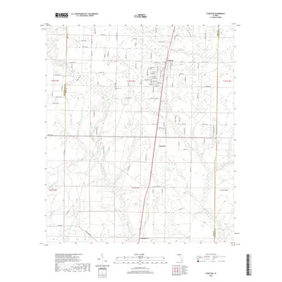
2018 Map of Fountain
USGS Topo · Published 2018About this map
Fountain and Youngstown anchor this central Florida landscape, where a dense network of local roads intersects with the hydrological features of the Panhandle. The map illustrates a transitional geography defined by numerous small waterways, including Juniper Cr and Bear Cr, which feed into the broader basin near Big Bear Bay. The settlement pattern follows a grid-like progression of named roads such as Robinson Ln and Smith Rd, reflecting the area's development around small rural communities. The inclusion of Saunders and markers like Bear Pond highlight the importance of specific local landmarks in navigating this terrain of creeks and branches. Notable for genealogists and researchers of local growth, the map clearly delineates the Washington Co Bay Co and Bay Co Calhoun Co boundary lines, providing a precise record of late-2010s land division and civil geography.
Find a feature on this map
117 named features on this map. Tap any name to fly to it.
Don’t see what you’re looking for? This feature index may not catch every label — zoom into the map to look around manually.
Map Details
Editions of this 2018 Fountain Map
This is the sole edition of this map. No revisions or reprints were ever made.
Other maps of this area

1944 · Bayhead
USGS Topo · 1:24,000

1944 · Bennett
USGS Topo · 1:24,000

1945 · Juniper Creek
USGS Topo · 1:31,680

1945 · Youngstown
USGS Topo · 1:31,680

1945 · Bennett
USGS Topo · 1:31,680

1945 · Bayhead
USGS Topo · 1:31,680

1945 · Broad Branch
USGS Topo · 1:31,680

1945 · Fountain
USGS Topo · 1:31,680

1950 · Gap Lake
USGS Topo · 1:24,000

1951 · Gap Pond
USGS Topo · 1:24,000