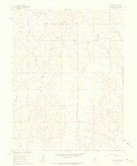
1961 Map of Fountain NE
USGS Topo · Published 1962About this map
Williams Creek and Chico Creek define the drainage of this El Paso County landscape, where ranching infrastructure and early utility developments meet. The territory is marked by family-named landmarks like Kane Ranch and the Bailey Windmill, indicating the reliance on groundwater in this arid stretch of Colorado. A major Pipeline cuts across the sections, reflecting post-war industrial expansion alongside the established Squirrel Creek Road. The presence of several survey markers, including VABM 5620 Hammer and various benchmarks like BM 5653, shows the precision of the U.S. Corps of Engineers and Geological Survey mapping efforts during this era of 1960s revision.
Find a feature on this map
15 named features on this map. Tap any name to fly to it.
Don’t see what you’re looking for? This feature index may not catch every label — zoom into the map to look around manually.
Map Details
Editions of this 1961 Fountain NE Map
2 editions found
Other maps of this area

1893 · Big Springs
USGS Topo · 1:125,000

1893 · Colorado Springs
USGS Topo · 1:125,000

1909 · Colorado Springs
USGS Topo · 1:125,000

1942 · Colorado Springs
USGS Topo · 1:125,000

1948 · Fountain SE
USGS Topo · 1:24,000

1948 · Fountain
USGS Topo · 1:24,000

1948 · Falcon
USGS Topo · 1:62,500
1949 · Buttes
USGS Topo · 1:24,000

1949 · Corral Bluffs
USGS Topo · 1:24,000
1950 · Elsmere
USGS Topo · 1:24,000