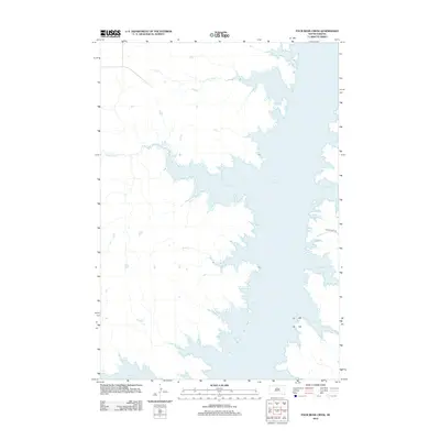
2012 Map of Four Bear Creek
USGS Topo · Published 2012About this map
Lake Oahe dominates this Dewey County landscape, its expansive waters filling the Missouri River valley and creating a complex network of inlets and peninsulas. The map details the jagged shoreline where the Missouri's ancient tributaries now meet the reservoir, including Four Bear Cr in the north and the meandering Buffalo Cr. These submerged valleys form prominent geographic features such as Buffalo Bay, Steamboat Bay, and Swift Bird Bay, which define the local topography.
Find a feature on this map
10 named features on this map. Tap any name to fly to it.
Don’t see what you’re looking for? This feature index may not catch every label — zoom into the map to look around manually.
Map Details
Editions of this 2012 Four Bear Creek Map
This is the sole edition of this map. No revisions or reprints were ever made.
Other maps of this area

1953 · McIntosh
USGS Topo · 1:250,000

1958 · McIntosh
USGS Topo · 1:250,000

1968 · Akaska SW
USGS Topo · 1:24,000

1968 · Moreau
USGS Topo · 1:24,000

1968 · Moreau SE
USGS Topo · 1:24,000

1969 · Patch Skin Buttes SW
USGS Topo · 1:24,000

1969 · Four Bear Creek
USGS Topo · 1:24,000

1969 · Patch Skin Buttes SE
USGS Topo · 1:24,000

1970 · Steamboat Creek
USGS Topo · 1:24,000

1970 · Patch Skin Buttes
USGS Topo · 1:24,000