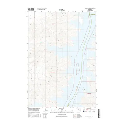
2015 Map of Four Bear Creek
USGS Topo · Published 2015About this map
The Missouri River corridor dominates this landscape at the intersection of Dewey, Potter, and Walworth Counties. This contemporary survey illustrates the vast expanse of Lake Oahe, the reservoir formed by the damming of the Missouri, which has reshaped the river valley into a complex system of inlets and flooded draws. Several significant drainages, including Four Bear Creek, Buffalo Cr, and Buck Cr, feed into the lake from the west. The map provides a clear look at the modern rural infrastructure, showing local routes like Bia-810 and Bia-808 that navigate the high ground above the water's edge. The detailed topography reveals the dramatic elevation changes between the prairie uplands and the submerged river valley, reflecting the significant hydrological changes that have defined this region since the mid-20th century.
Find a feature on this map
15 named features on this map. Tap any name to fly to it.
Don’t see what you’re looking for? This feature index may not catch every label — zoom into the map to look around manually.
Map Details
Editions of this 2015 Four Bear Creek Map
This is the sole edition of this map. No revisions or reprints were ever made.
Other maps of this area

1953 · McIntosh
USGS Topo · 1:250,000

1958 · McIntosh
USGS Topo · 1:250,000

1968 · Akaska SW
USGS Topo · 1:24,000

1968 · Moreau
USGS Topo · 1:24,000

1968 · Moreau SE
USGS Topo · 1:24,000

1969 · Patch Skin Buttes SW
USGS Topo · 1:24,000

1969 · Four Bear Creek
USGS Topo · 1:24,000

1969 · Patch Skin Buttes SE
USGS Topo · 1:24,000

1970 · Steamboat Creek
USGS Topo · 1:24,000

1970 · Patch Skin Buttes
USGS Topo · 1:24,000