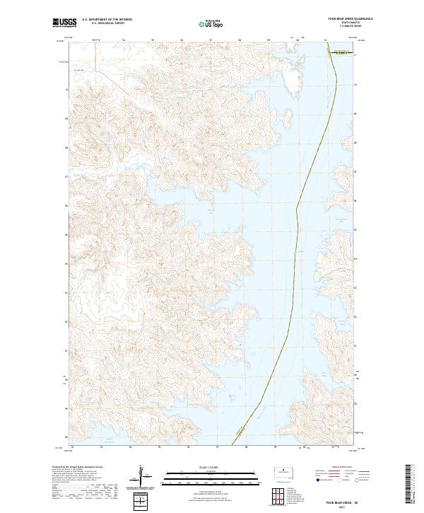
2021 Map of Four Bear Creek
USGS Topo · Published 2021About this map
The Missouri River forms the central corridor of this Dakota landscape, where its waters expand into the broad reach of Lake Oahe. The map details a complex shoreline defined by numerous indentations, including Buffalo Bay, Steamboat Bay, and Swift Bird Bay. These features reflect the contemporary geography of the Missouri after the mid-century damming projects, which transformed the river valley into a series of massive reservoirs.
Find a feature on this map
18 named features on this map. Tap any name to fly to it.
Don’t see what you’re looking for? This feature index may not catch every label — zoom into the map to look around manually.
Map Details
Editions of this 2021 Four Bear Creek Map
This is the sole edition of this map. No revisions or reprints were ever made.
Other maps of this area

1953 · McIntosh
USGS Topo · 1:250,000

1958 · McIntosh
USGS Topo · 1:250,000

1968 · Akaska SW
USGS Topo · 1:24,000

1968 · Moreau
USGS Topo · 1:24,000

1968 · Moreau SE
USGS Topo · 1:24,000

1969 · Patch Skin Buttes SW
USGS Topo · 1:24,000

1969 · Four Bear Creek
USGS Topo · 1:24,000

1969 · Patch Skin Buttes SE
USGS Topo · 1:24,000

1970 · Steamboat Creek
USGS Topo · 1:24,000

1970 · Patch Skin Buttes
USGS Topo · 1:24,000