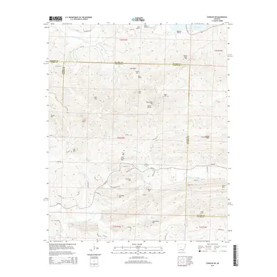
2014 Map of Fourche SW
USGS Topo · Published 2014About this map
Cold Spring Cem and the surrounding peaks of the Ouachita foothills define this corner of Central Arkansas, where the Maumelle River feeds into the western reaches of Lake Maumelle. The landscape is a complex network of ridges and hollows, including named elevations like Crystal Mtn, Horseshoe Mtn, and Pigeon Roost Mtn. In the southern portion of the sheet, the North Fork Saline River flows through a valley overlooked by Schoolhouse Mtn, suggesting the sites of early local gathering places and rural development along the river's edge.
Find a feature on this map
77 named features on this map. Tap any name to fly to it.
Don’t see what you’re looking for? This feature index may not catch every label — zoom into the map to look around manually.
Map Details
Editions of this 2014 Fourche SW Map
This is the sole edition of this map. No revisions or reprints were ever made.
Other maps of this area

1890 · Benton
USGS Topo · 1:125,000

1894 · Benton
USGS Topo · 1:125,000

1938 · Benton
USGS Topo · 1:48,000

1944 · Benton
USGS Topo · 1:62,500

1955 · Little Rock
USGS Topo · 1:250,000

1956 · Little Rock
USGS Topo · 1:250,000

1960 · Little Rock
USGS Topo · 1:250,000
1961 · Fourche
USGS Topo · 1:24,000
1963 · Thornburg
USGS Topo · 1:24,000

1963 · Fourche SW
USGS Topo · 1:24,000