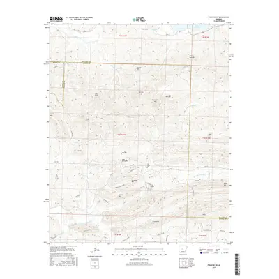
2017 Map of Fourche SW
USGS Topo · Published 2017About this map
Pigeon Roost Mtn and Crystal Mtn define a complex upland landscape where the headwaters of several critical drainage systems emerge. The northern portion of this terrain is dominated by the Maumelle River and the southwestern reach of Lake Maumelle, while the southern reaches fall away toward the North Fork Saline River. The area is characterized by numerous named peaks and ridges, including the prominently situated Rattlesnake Mtn and Fall Mtn.
Find a feature on this map
71 named features on this map. Tap any name to fly to it.
Don’t see what you’re looking for? This feature index may not catch every label — zoom into the map to look around manually.
Map Details
Editions of this 2017 Fourche SW Map
This is the sole edition of this map. No revisions or reprints were ever made.
Other maps of this area

1890 · Benton
USGS Topo · 1:125,000

1894 · Benton
USGS Topo · 1:125,000

1938 · Benton
USGS Topo · 1:48,000

1944 · Benton
USGS Topo · 1:62,500

1955 · Little Rock
USGS Topo · 1:250,000

1956 · Little Rock
USGS Topo · 1:250,000

1960 · Little Rock
USGS Topo · 1:250,000
1961 · Fourche
USGS Topo · 1:24,000
1963 · Thornburg
USGS Topo · 1:24,000

1963 · Fourche SW
USGS Topo · 1:24,000