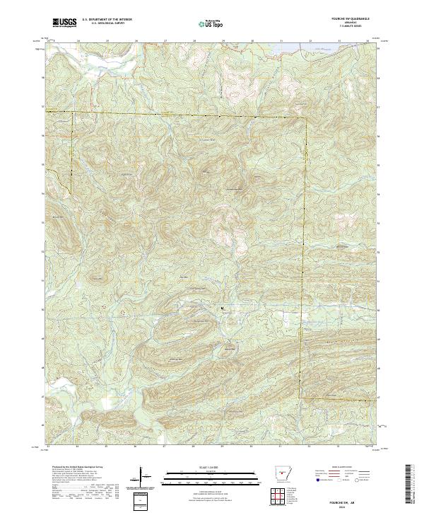
2024 Map of Fourche SW
USGS Topo · Published 2024About this map
The North Fork Saline River and the upper reaches of the Maumelle River define this complex upland landscape where the boundaries of Saline, Pulaski, and Perry counties converge. The terrain is marked by numerous named peaks and ridges, such as Rattlesnake Mtn, Crystal Mtn, and Pigeon Roost Mtn, separated by deep hollows like Rush Hollow and Wilhite Hollow. This 2024 survey shows a landscape of limited residential development, with Alex Acres providing a small pocket of settlement against the backdrop of larger timber and conservation tracts.
Find a feature on this map
76 named features on this map. Tap any name to fly to it.
Don’t see what you’re looking for? This feature index may not catch every label — zoom into the map to look around manually.
Map Details
Editions of this 2024 Fourche SW Map
This is the sole edition of this map. No revisions or reprints were ever made.
Other maps of this area

1890 · Benton
USGS Topo · 1:125,000

1894 · Benton
USGS Topo · 1:125,000

1938 · Benton
USGS Topo · 1:48,000

1944 · Benton
USGS Topo · 1:62,500

1955 · Little Rock
USGS Topo · 1:250,000

1956 · Little Rock
USGS Topo · 1:250,000

1960 · Little Rock
USGS Topo · 1:250,000
1961 · Fourche
USGS Topo · 1:24,000
1963 · Thornburg
USGS Topo · 1:24,000

1963 · Fourche SW
USGS Topo · 1:24,000