
1972 Map of Fourmile Flat
USGS Topo · Published 1975About this map
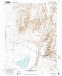
Fourmile Flat (Alkali) and the Salt Wells Basin dominate this high-desert topography, where the arid landscape reveals a history of early western transit. A notable Historical Marker (Site of Sand Springs Pony Express Station) identifies the location of a vital stop on the mid-19th-century mail route, situated near the Sand Springs water source. The map captures a mix of transit and industry, featuring a stretch of Highway 50 cutting through the alkaline flats and various Borrow Pits and Prospects at the base of the Stillwater Range. Isolated landmarks like a solitary Grave and Ruins suggest the difficult living conditions of previous eras. Water management is evident through the Tunnel Spring Windmill and Sand Mountain Windmill, providing essential resources for cattle or mining operations within the shifting Sand Dunes.
Find a feature on this map
22 named features on this map. Tap any name to fly to it.
Don’t see what you’re looking for? This feature index may not catch every label — zoom into the map to look around manually.
Map Details
Editions of this 1972 Fourmile Flat Map
3 editions found
Other maps of this area

1908 · Carson Sink
USGS Topo · 1:250,000

1910 · Carson Sink
USGS Topo · 1:250,000

1951 · Carson Lake
USGS Topo · 1:62,500

1951 · Allen Springs
USGS Topo · 1:62,500

1957 · Reno
USGS Topo · 1:250,000

1959 · Reno
USGS Topo · 1:250,000

1960 · Reno
USGS Topo · 1:250,000

1972 · Diamond Canyon
USGS Topo · 1:24,000
1972 · Frenchman
USGS Topo · 1:24,000
1972 · La Plata Canyon
USGS Topo · 1:24,000