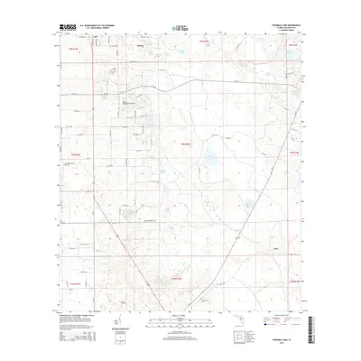
2015 Map of Fourmile Lake
USGS Topo · Published 2015About this map
Fourmile Lake and a dense network of karst ponds and marshes characterize this central Gilchrist County landscape. The settlement of Bell sits at the northern edge, while the rural communities of Mutual and Tyler anchor the surrounding agricultural and timber lands. The area is notable for several private aviation landmarks, including the Flying Harness Farms Airport, Saw Whet Farms Airport, and the Watson Flight Strip, reflecting the integration of air travel into the region's farm operations. Local history is anchored at the Joppa Cem and Trenton Cem, while numerous smaller water bodies like Weeks Waterhole and Negro Pond highlight the unique limestone-driven hydrology of the Florida interior. The map reveals an intricate grid of county roads and trails, such as CR-232 and W Suwannee St, that connect these disparate settlements and farmsteads.
Find a feature on this map
86 named features on this map. Tap any name to fly to it.
Don’t see what you’re looking for? This feature index may not catch every label — zoom into the map to look around manually.
Map Details
Editions of this 2015 Fourmile Lake Map
This is the sole edition of this map. No revisions or reprints were ever made.
Other maps of this area

1954 · Gainesville
USGS Topo · 1:250,000

1958 · Gainesville
USGS Topo · 1:250,000

1959 · Gainesville
USGS Topo · 1:250,000

1968 · Newberry SW
USGS Topo · 1:24,000

1968 · Waters Lake
USGS Topo · 1:24,000

1968 · Fourmile Lake
USGS Topo · 1:24,000

1968 · Hatchbend
USGS Topo · 1:24,000

1968 · Trenton
USGS Topo · 1:24,000
1968 · Suwannee River
USGS Topo · 1:24,000
1968 · Wannee
USGS Topo · 1:24,000