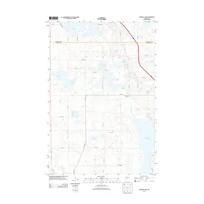
2013 Map of Fourmile Lake
USGS Topo · Published 2013About this map
Pomme de Terre Lake and the winding Pomme de Terre River define the southeastern corner of this glaciated landscape along the border of Otter Tail and Grant counties. The area is densely packed with water bodies typical of the region's pothole geology, including Tenmile Lake, Fourmile Lake, and the centrally located Skunk Lake. The map reveals a deeply rooted rural community evidenced by its numerous burial grounds, such as Hjerdal Cem, Christ Cem, and Bethlehem Cem. A complex network of township roads, including Twp Hwy 122 and Twp Hwy 127, provides access to the scattered farmsteads and lakeshores. The presence of Mill Pond near Pelican Cr suggests historical water-use patterns that shaped the local settlement long before this modern survey.
Find a feature on this map
43 named features on this map. Tap any name to fly to it.
Don’t see what you’re looking for? This feature index may not catch every label — zoom into the map to look around manually.
Map Details
Editions of this 2013 Fourmile Lake Map
This is the sole edition of this map. No revisions or reprints were ever made.
Other maps of this area

1910 · Wendell
USGS Topo · 1:62,500

1911 · Barrett
USGS Topo · 1:62,500

1911 · Herman
USGS Topo · 1:62,500

1913 · Ashby
USGS Topo · 1:62,500

1913 · Wendell
USGS Topo · 1:62,500

1953 · Milbank
USGS Topo · 1:250,000

1953 · Fargo
USGS Topo · 1:250,000

1953 · Brainerd
USGS Topo · 1:250,000

1953 · Saint Cloud
USGS Topo · 1:250,000

1956 · Fargo
USGS Topo · 1:250,000