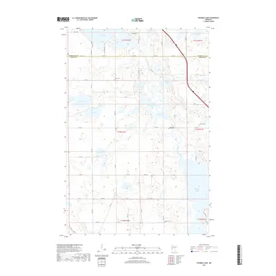
2019 Map of Fourmile Lake
USGS Topo · Published 2019About this map
The Pomme de Terre River and its associated valley dominate the eastern half of this landscape on the border of Otter Tail and Grant Counties. A dense concentration of prairie lakes and marshes, including Fourmile Lake, Tenmile Lake, and Skunk Lake, characterizes the glacial topography of the region. This 2019 survey documents a rural agricultural environment organized by a strict grid of section roads like County Highway 4 and 290th Street. Genealogists will find several burial sites preserved across the townships, such as Hjerdal Cem, Pomme de Terre Cem, and Bethlehem Cem. The northern portion of Pomme de Terre Lake serves as a major landmark at the southern edge, while smaller water bodies like Grinder Lake and Horseshoe Lake are pocketed among the undulating fields and wetlands.
Find a feature on this map
45 named features on this map. Tap any name to fly to it.
Don’t see what you’re looking for? This feature index may not catch every label — zoom into the map to look around manually.
Map Details
Editions of this 2019 Fourmile Lake Map
This is the sole edition of this map. No revisions or reprints were ever made.
Other maps of this area

1910 · Wendell
USGS Topo · 1:62,500

1911 · Barrett
USGS Topo · 1:62,500

1911 · Herman
USGS Topo · 1:62,500

1913 · Ashby
USGS Topo · 1:62,500

1913 · Wendell
USGS Topo · 1:62,500

1953 · Milbank
USGS Topo · 1:250,000

1953 · Fargo
USGS Topo · 1:250,000

1953 · Brainerd
USGS Topo · 1:250,000

1953 · Saint Cloud
USGS Topo · 1:250,000

1956 · Fargo
USGS Topo · 1:250,000