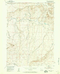
1953 Map of Fourmile Point
USGS Topo · Published 1958About this map
Shirley Basin provides the foundational landscape for this Wyoming survey, revealing a high-altitude ranching environment defined by its drainage networks. The northern edge is dominated by the Rim and heights of Chalk Mtn, while the interior is crisscrossed by seasonal waterways like Dry Creek and Bolton Creek. The presence of the Meer Ranch near the center of the quadrangle suggests the localized scale of agricultural operations in the mid-20th century.
Find a feature on this map
18 named features on this map. Tap any name to fly to it.
Don’t see what you’re looking for? This feature index may not catch every label — zoom into the map to look around manually.
Map Details
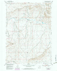
Editions of this 1953 Fourmile Point Map
3 editions found
Other maps of this area

1951 · Bear Mountain
USGS Topo · 1:24,000

1951 · Bear Spring
USGS Topo · 1:24,000

1953 · Fourmile Point
USGS Topo · 1:24,000

1953 · Fourmile Ridge
USGS Topo · 1:24,000

1953 · The Q Ranch
USGS Topo · 1:24,000

1953 · Beaver Creek
USGS Topo · 1:24,000

1955 · Casper
USGS Topo · 1:250,000

1958 · Casper
USGS Topo · 1:250,000

1960 · Wild Irish Reservoir
USGS Topo · 1:24,000

1960 · Horse Peak
USGS Topo · 1:24,000