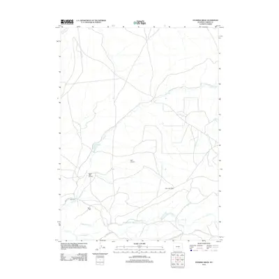
2012 Map of Fourmile Ridge
USGS Topo · Published 2012About this map
Fourmile Ridge dominates the center of this high-desert landscape in Carbon County, where a complex network of seasonal drainage channels carves through the terrain. The presence of Mine Hill and the remote Irene Ranch along Werner Ranch Rd indicates a landscape shaped by intermittent livestock operations and resource extraction. The area is defined by its dramatic relief, specifically around Wolf Canyon and North Wolf Canyon, where the topography drops into the plains. Water management and natural flow are critical here, as evidenced by the convergence of the Middle Fork Sage Cr, South Fork Sage Cr, and Sage Cr in the southern portion of the quadrangle. Early 21st-century ranching access is facilitated by established routes like Kortes Rd and the Leo Shirley Basin Rd, which provide connection points across this sparsely populated region of Wyoming.
Find a feature on this map
17 named features on this map. Tap any name to fly to it.
Don’t see what you’re looking for? This feature index may not catch every label — zoom into the map to look around manually.
Map Details
Editions of this 2012 Fourmile Ridge Map
This is the sole edition of this map. No revisions or reprints were ever made.
Other maps of this area

1951 · Bear Mountain
USGS Topo · 1:24,000

1951 · Bear Spring
USGS Topo · 1:24,000

1951 · Pathfinder Dam
USGS Topo · 1:24,000

1953 · Leo
USGS Topo · 1:24,000

1953 · Seminoe Dam NE
USGS Topo · 1:24,000

1953 · Fourmile Point
USGS Topo · 1:24,000

1953 · Fourmile Ridge
USGS Topo · 1:24,000

1953 · The Q Ranch
USGS Topo · 1:24,000

1953 · Beaver Creek
USGS Topo · 1:24,000

1955 · Casper
USGS Topo · 1:250,000