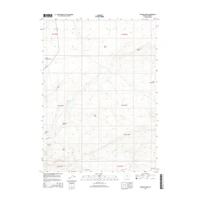
2015 Map of Fourmile Ridge
USGS Topo · Published 2015About this map
Fourmile Ridge dominates this high-altitude Carbon County landscape, where the drainage systems of Middle Fork Sage Cr and Alkali Cr carve through the arid terrain. The map reveals a network of land management and ranching infrastructure, evidenced by isolated features like Irene Reservoir and several named draws including Reno Draw and Sneftens Draw. Access across these townships is maintained by a few primitive routes such as Kortes Rd and Werner Ranch Rd, reflecting the remote character of the region.
Find a feature on this map
29 named features on this map. Tap any name to fly to it.
Don’t see what you’re looking for? This feature index may not catch every label — zoom into the map to look around manually.
Map Details
Editions of this 2015 Fourmile Ridge Map
This is the sole edition of this map. No revisions or reprints were ever made.
Other maps of this area

1951 · Bear Mountain
USGS Topo · 1:24,000

1951 · Bear Spring
USGS Topo · 1:24,000

1951 · Pathfinder Dam
USGS Topo · 1:24,000

1953 · Leo
USGS Topo · 1:24,000

1953 · Seminoe Dam NE
USGS Topo · 1:24,000

1953 · Fourmile Point
USGS Topo · 1:24,000

1953 · Fourmile Ridge
USGS Topo · 1:24,000

1953 · The Q Ranch
USGS Topo · 1:24,000

1953 · Beaver Creek
USGS Topo · 1:24,000

1955 · Casper
USGS Topo · 1:250,000