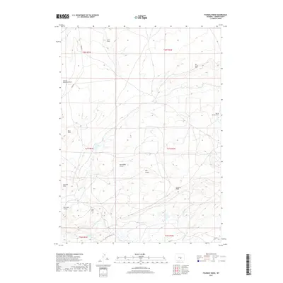
2017 Map of Fourmile Ridge
USGS Topo · Published 2017About this map
Fourmile Ridge dominates the southern landscape of this 2017 topographic survey, marking a complex network of draws and canyons in rural Carbon County. The terrain is defined by dramatic elevation changes where Dry Creek Rim and Mine Hill rise above a series of drainages, including the expansive McFade Waterhole Draw and Horse Springs Draw. Transportation in this high-plains environment is sparse, centered on Kortes Rd and the Leo Shirley Basin Rd, which provide access to this isolated area. The drainage pattern is particularly intricate, with Wolf Canyon and North Wolf Canyon carving into the plateau near Sneftens Draw. This modern map records the specific hydrological features of the Shirley Basin region, noting multiple branches of Sage Creek such as Middle Fork Sage Cr and S Fork Sage Cr, essential water sources in this arid Wyoming landscape.
Find a feature on this map
27 named features on this map. Tap any name to fly to it.
Don’t see what you’re looking for? This feature index may not catch every label — zoom into the map to look around manually.
Map Details
Editions of this 2017 Fourmile Ridge Map
This is the sole edition of this map. No revisions or reprints were ever made.
Other maps of this area

1951 · Bear Mountain
USGS Topo · 1:24,000

1951 · Bear Spring
USGS Topo · 1:24,000

1951 · Pathfinder Dam
USGS Topo · 1:24,000

1953 · Leo
USGS Topo · 1:24,000

1953 · Seminoe Dam NE
USGS Topo · 1:24,000

1953 · Fourmile Point
USGS Topo · 1:24,000

1953 · Fourmile Ridge
USGS Topo · 1:24,000

1953 · The Q Ranch
USGS Topo · 1:24,000

1953 · Beaver Creek
USGS Topo · 1:24,000

1955 · Casper
USGS Topo · 1:250,000