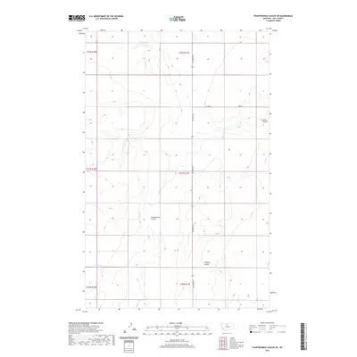
2020 Map of Fourteenmile Coulee NE
USGS Topo · Published 2020About this map
Fourteenmile Coulee carves through the central high plains of Hill County, defining the drainage patterns of this sparsely settled landscape. The map illustrates a strictly surveyed grid of section lines across Townships 30 through 32 North, where infrastructure is limited to essential rural routes like Gilford Rd S and Co Rd 605. Small topographical variations are marked by distinctive local features such as Faulkners Coulee in the northeast and Halfway Coulee to the south. This 2020 survey reflects a contemporary view of Montana's agricultural interior, where land use remains primarily tied to the natural contours and watercourses of the coulee systems, with few permanent structures or dense developments present in this portion of the northern plains.
Find a feature on this map
12 named features on this map. Tap any name to fly to it.
Don’t see what you’re looking for? This feature index may not catch every label — zoom into the map to look around manually.
Map Details
Editions of this 2020 Fourteenmile Coulee NE Map
This is the sole edition of this map. No revisions or reprints were ever made.
Other maps of this area

1904 · Boxelder
USGS Topo · 1:62,500

1906 · Kremlin
USGS Topo · 1:62,500

1906 · Boxelder
USGS Topo · 1:62,500

1919 · Big Sandy
USGS Topo · 1:125,000

1920 · Gildford
USGS Topo · 1:125,000

1943 · Gildford
USGS Topo · 1:125,000

1954 · Shelby
USGS Topo · 1:250,000

1958 · Shelby
USGS Topo · 1:250,000
1969 · Sage Lake
USGS Topo · 1:24,000

1969 · Box Elder NW
USGS Topo · 1:24,000