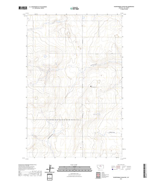
2024 Map of Fourteenmile Coulee NE
USGS Topo · Published 2024About this map
The drainage patterns of Hill County define this northern Montana landscape, where the seasonal waters of Fourteenmile Coulee and Faulkners Coulee have carved distinct paths across the high plains. The terrain is characterized by these deep coulees and wide prairie stretches, largely organized by the Public Land Survey System into townships such as t31n r11e and t32n r11e. Human impact on the land is concentrated along transit corridors like Gilford Rd S, which cuts north-south across the center of the quadrangle.
Find a feature on this map
13 named features on this map. Tap any name to fly to it.
Don’t see what you’re looking for? This feature index may not catch every label — zoom into the map to look around manually.
Map Details
Editions of this 2024 Fourteenmile Coulee NE Map
This is the sole edition of this map. No revisions or reprints were ever made.
Other maps of this area

1904 · Boxelder
USGS Topo · 1:62,500

1906 · Kremlin
USGS Topo · 1:62,500

1906 · Boxelder
USGS Topo · 1:62,500

1919 · Big Sandy
USGS Topo · 1:125,000

1920 · Gildford
USGS Topo · 1:125,000

1943 · Gildford
USGS Topo · 1:125,000

1954 · Shelby
USGS Topo · 1:250,000

1958 · Shelby
USGS Topo · 1:250,000
1969 · Sage Lake
USGS Topo · 1:24,000

1969 · Box Elder NW
USGS Topo · 1:24,000