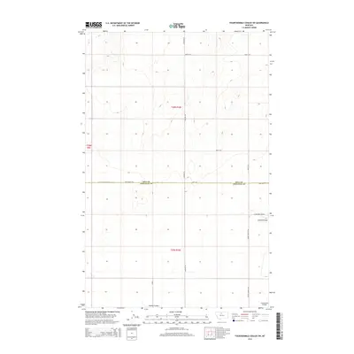
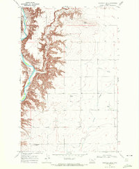
2014 Map of Fourteenmile Coulee SW
USGS Topo · Published 2014About this map
Hill and Chouteau County boundaries divide this high plains landscape, where the vast, open expanse of Lonesome Prairie dominates the southeastern quadrant. The terrain is defined by wide drainages and subtle elevation changes, most notably the winding path of Sixmile Coulee as it cuts through the northern part of t29n r10e. The section lines and gravel road network, including Hingham Road and Road 130 S, reveal a highly organized agricultural grid typical of the Montana plains in the early 21st century.
Find a feature on this map
15 named features on this map. Tap any name to fly to it.
Don’t see what you’re looking for? This feature index may not catch every label — zoom into the map to look around manually.
Map Details
Editions of this 2014 Fourteenmile Coulee SW Map
This is the sole edition of this map. No revisions or reprints were ever made.
Other maps of this area

1906 · Lonesome
USGS Topo · 1:62,500

1919 · Big Sandy
USGS Topo · 1:125,000

1954 · Shelby
USGS Topo · 1:250,000

1958 · Shelby
USGS Topo · 1:250,000

1969 · Fourteenmile Coulee SW
USGS Topo · 1:24,000

1969 · Fourteenmile Coulee NW
USGS Topo · 1:24,000
1969 · Kenilworth
USGS Topo · 1:24,000
1969 · Fourteenmile Coulee SE
USGS Topo · 1:24,000
1969 · Fourteenmile Coulee NE
USGS Topo · 1:24,000
1969 · Discovery Butte
USGS Topo · 1:24,000